Five types of overarching vulnerabilities have been identified by the ART Program: certain land uses, population characteristics, networked infrastructure, information gaps, and emergency preparedness and response. Each of these has potentially significant negative effects on public health and safety, equity, the economy, and/or the environment. Taken together, they provide insight into the challenges the subregion will face as sea level rises and consequences that might occur if the identified vulnerabilities are not addressed in a timely and effective manner.
Certain Land Uses 
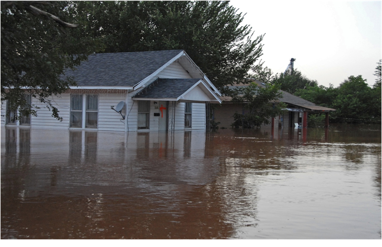
Photo credit: N. Handler
Certain types of land uses are particularly vulnerable because of the specific functions they serve, and because they are difficult to protect, evacuate, or rebuild. If these land uses are damaged or their function disrupted there can be significant consequences on public health and safety. Many of the plans, policies and practices that guide land use and capital investments do not consider sea level rise or storm events, and action at the local, regional, state and federal levels will be necessary to ensure that as the region grows that these land uses, and the people who rely on them, are not put at risk.
Population Characteristics
Some characteristics that can make individual members of a community, or a community as a whole, especially vulnerable to sea level rise and storm events. These include lacking the financial means, the physical capacity, necessary information, or access to services to prepare for and respond to flooding or other hazards. Past disasters have demonstrated the consequences for public health and safety, as well as the local and regional economy, of not factoring specific community characteristics and needs into emergency and land use planning and policy making.
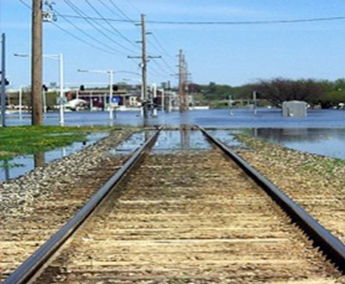
Photo credit: Joe Klocek
Networked Infrastructure
Infrastructure that is connected as a continuous corridor or as a series of contiguous segments is particularly susceptible to disruption because it is generally only as resilient as its weakest link. Disruptions to one segment can cause cascading, secondary impacts in adjoining segments or even farther away, resulting in a system-wide failure. This is especially true for long and linear ground transportation assets in the ART subregion such as the Bay Trail and the regional rail system, as well as the utility infrastructure and the system of shoreline protection along the Bay’s edge. Disruption of networked infrastructure can cause widespread economic and community consequences. The people and property that are protected by, or rely on these systems, should be included in planning and funding decisions regarding maintenance, repair or upgrade.
Information Gaps
There were significant gaps in the quality and availability of information needed to understand the social and physical dimensions of vulnerability and risk for every asset category assessed. For example, there is a growing but still limited understanding of how natural, dynamic shoreline systems will respond to sea level rise, a lack of centrally coordinated, up-to-date, accurate information about hazardous material sites and contaminated lands, and limited access and availability of information on the ownership, location and condition of energy, pipeline, telecommunication, and stormwater infrastructure. These information challenges make it difficult to accurately characterize the vulnerability of shoreline communities and assets, and pose a barrier to further action.
Emergency Preparation and Response
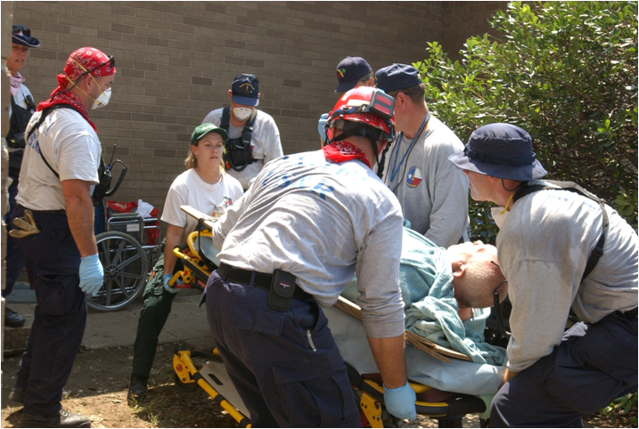
Photo credit: Jocelyn Augustino
Emergency plans, policies and practices in the in many parts of the Bay Area do not consider storm events that could affect areas not currently at risk of flooding, or the contingencies and secondary impacts associated with widespread or longer lasting future storm events. Most plans do not identify or address the specific needs of particularly vulnerable community members, and the information necessary to improve these plans is not always available, correct, up-to-date, or easily accessible. In addition, those that own or manage community assets, such as transportation and utility infrastructure that are critical during an emergency or disaster, do not have control over the lands that provide access to their facilities or the shoreline that protects them. Targeted information gathering and coordinated and, in some cases, shared decision making will all be necessary to avoid the widespread consequences of not addressing future flood risks.
Links:

For more information:
- Dana Brechwald
- Dana.Brechwald@bcdc.ca.gov
- 415-352-3656