Adapting to Rising Tides (ART) Bay Area is the first ever regional look at sea level rise impacts around the Bay. Read the official press release below, or access the full report available for download here.
Official Press Release
San Francisco, CA – Caltrans, Metropolitan Transportation Commission/Association of Bay Area Governments, Bay Area Regional Collaborative, and San Francisco Bay Conservation and Development Commission are pleased to announce the release of Adapting to Rising Tides (ART) Bay Area.
ART Bay Area is a product of a multi-agency collaboration, illuminating shared vulnerability to sea level rise across regional systems that Bay Area residents depend on to live and thrive.
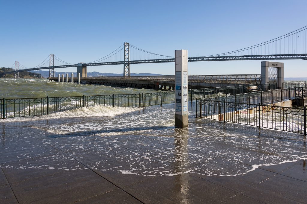
No matter where you live in the Bay Area, shoreline flooding from sea level rise and storm events will affect how you live. Driving on highways will be affected by as little as one foot of flooding, halting the commutes of hundreds of thousands of residents and visitors daily. With two feet of flooding, communities will start feeling serious impacts to their homes and jobs. Rising sea level will fundamentally change our relationships with the Bay, including threatening our public access to the shoreline and enjoying of shoreline recreation. And, our natural habitats are truly at risk.
But these impacts do not have to happen –some local planning is underway, and we need more, faster, and more coordinated planning to face the full magnitude of impacts. Planning how to adapt is an opportunity to address current issues and future threats.
Download the ART Bay Area Report Short Summary and Full Report here!
What is ART Bay Area?
ART Bay Area is the first ever regional comparison of the impacts of rising sea level on people, the environment, and the regional systems we rely on. This report provides a better understanding of where we are vulnerable and lays out a pathway to plan for the future.
ART Bay Area illuminates potential impacts of flooding to four critical region-wide systems: transportation, future growth areas, natural lands, and vulnerable communities.
How Was the Report Done?
To support the region-wide analysis, we initiated 32 local deep dive studies were done to deeply understand how these impacts could play out within a community. These systems and locations were analyzed at a total of ten flood levels ranging from 12” to 108” to show a wide range of impacts over time.
We are grateful for the nearly 600 community members, nonprofit organizations, city and county planners, business representatives, elected officials, and state and federal staff who engaged with us in developing this study over the past three years.
Why Now?
Sea level rise is just one of many factors that will influence how we live, work, and engage with our environment and communities in the Bay Area in coming decades – and the cost of inaction is too high.
The urgency is clear – the impacts of rising sea level will be felt sooner than we previously thought, and even lower levels of flooding will have serious impacts on critical services such as transportation networks and jobs.
The current global health crisis caused by COVID-19 is a reminder that our collective future can be an uncertain one. Sea level rise is just one of many factors that will influence how we live, work, and engage with our environment and communities in the Bay Area in coming decades – and the cost of inaction is too high. It may also serve as a reminder of two things: that our society can and will come together for the greater good, and that targeted, coordinated action can create better outcomes for the future. ART Bay Area helps move the region forward in making proactive decisions about how best to manage sea level rise to ensure that our future is safe and resilient.
Access the Short Report and Full Report
Access the ART Bay Area page to download the ART Bay Area Short Report: Summary of Regional Sea Level Rise Vulnerability and Adaptation Study, the Main Report, and the four individual chapters: Transportation Networks, Vulnerable Communities, Future Growth Areas, and Natural Lands. Additionally, there are thirteen individual Local Assessments available for download that provide details on shared vulnerabilities in locations around the nine-county San Francisco Bay Area.
For more information on this project, contact:
Dana Brechwald
Adapting to Rising Tides Program Manager, San Francisco Bay Conservation and Development Commission
Allison Brooks
Executive Director, Bay Area Regional Collaborative